The concept of open data is revolutionizing the way we manage and utilize information, allowing everyone to access public data transparently and for free. The European project Horizon 2020 SPOTTED has harnessed this potential by using open data provided by municipalities to develop innovative urban solutions.

One of the main open data used in the project includes geospatial information of cities, such as administrative boundaries, road networks, green areas, and points of interest (POI). These datasets, made available by municipalities, form the basis for numerous analyses and applications.

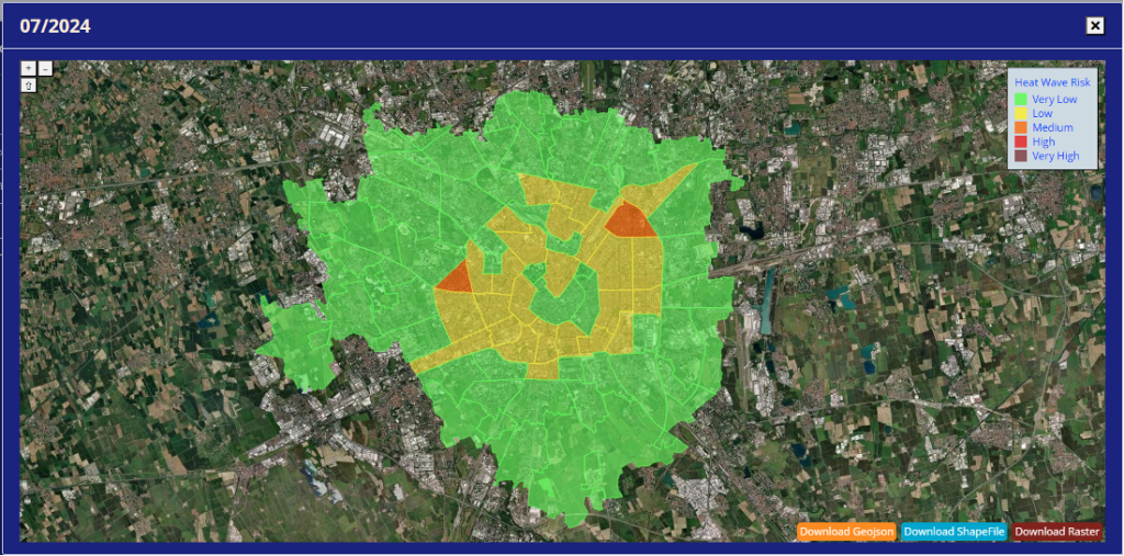
MILAN – NIL
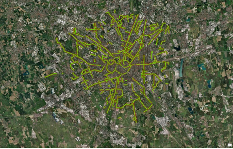
MILAN – CYCLE PATH
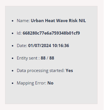
To ensure that the open data is ready for use and error-free, SPOTTED has implemented a robust pre-processing system. This system can handle open data even when they present issues, notifying the user of any detected errors. The platform developed by SPOTTED can manage a large number of entities and ensures an efficient and reliable workflow.
Among the controls implemented in the system are:
- Point z: verification of the correctness of altitude coordinates.
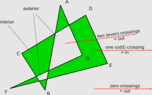
- Self-intersecting polygon: detection of polygons that intersect with themselves.
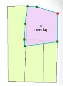
- Overlapping: identification of overlapping polygons.
- Incorrect georeferencing: data outside the area of interest.
- EPSG 4326: verification of the spatial reference system.
The final output of the SPOTTED project is available in geojson and shapefile formats, ensuring easy integration into municipal GIS systems. This approach not only facilitates the use of open data but also promotes the adoption of urban management practices based on accurate and up-to-date data, leading to smarter and more sustainable cities.